The Tauranga Valley Bridge, also known as the Tauranga Track Bridge, is one of only two remaining early New Zealand harp or cable stayed bridges. The bridge was constructed as a means of accessing farms established by the government for servicemen returning from World War One over the Waioweka River from the main road north to Ōpōtiki.
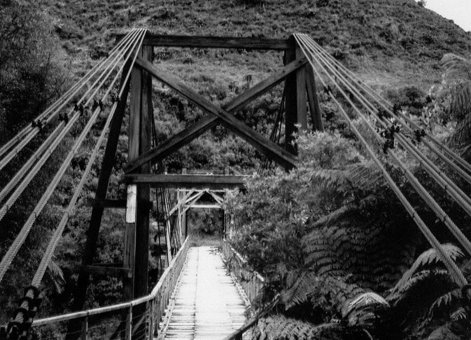
Tauranga Suspension Bridge, IPENZ Geoffrey Thornton Collection
This timber bridge with Australian hardwood trestle towers, and concrete piers, was designed between 1916 and 1918 by the Public Works Department (PWD) and built in 1922. The single span is 57.8 metres long. The 3m wide deck is supported by 6 transoms at 6 points between the towers, and each transom is in turn supported by a steel cable that is continuous between the anchor sets on each side of the river.
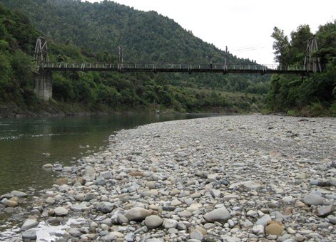
Tauranga Valley Bridge, 2011. Photograph courtesy of J.La Roche.
The PWD engineers who designed the bridge adapted the use of steel rope to the English multi-rod system and combined some good kiwi ingenuity with an American initiative in the development of steel rope suspension bridge construction.
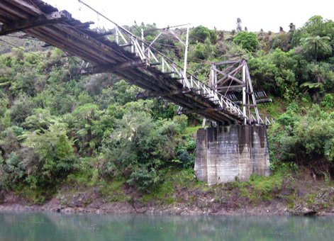
Tauranga Valley Bridge, 2011. Photograph courtesy of J. La Roche 2
The farms that the bridge provided access to were abandoned by the 1960s. By the 1990s the bridge had become isolated because of the state of the roads leading up to it, and as such was degraded to the point of being unusable. The Department of Conservation (DOC) manages the Waioweka Gorge Scenic Reserve, and in February 1992 Ron Campbell of Ōpōtiki brought to their attention the urgent need to stabilise the true right tower. Ron then completed this work, which undoubtedly saved the bridge from collapse. In 1994 further conservation works were completed by DOC and the bridge was formally reopened to pedestrian traffic on 11 March 1995.
Heritage recognition
This place has been recognised by Heritage New Zealand as a Category 1 historic place (List no.7221): Tauranga Bridge: New Zealand Heritage List/Rarangi Korero information.
Find out more
Access
The Department of Conservation website features history and access information.
Further reading
G Thornton, Bridging the Gap: Early bridges in New Zealand, 1830-1939(Auckland: Reed, 2001), pp.178–80.
Location
South of Ōpōtiki, close to State Highway 2, East Coast.