Throughout the terrible winter of 1865, labourers began cutting a coach road from Christchurch through the Ōtira Gorge and over Arthur’s Pass to the West Coast goldfields. This road, which is now State Highway 73, was built with picks, shovels, wheelbarrows and two-horse drays.
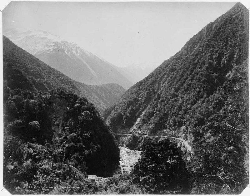
Burton Brothers (Dunedin, N.Z.). Otira Gorge, showing West Coast road. Ref: 1/2-061329-F. Alexander Turnbull Library, Wellington, New Zealand. /records/22312954
The Ōtira Gorge and Arthur’s Pass road extends 13.4 kilometres between the townships of Arthur’s Pass and Ōtira. The Pass summit is 922 metres above sea level, with Arthur’s Pass township at 762m and Ōtira at 427m. Tight constraints were placed on the geometric layout as a result of mountainous topography, geological instability, adverse weather conditions and the limitations of the corridors available.
The construction through the Pass in atrocious weather conditions was completed in 10 months and the original coach road was opened in March 1866. Some realisation of the terrible conditions in which those early road builders worked can be gained from recent data on the climate at Arthur’s Pass. An average annual rainfall of 4,000 to 7,000 millimetres per year is recorded and snowfalls during winter are frequent, with minimum temperatures ranging between -1 and -2 degree Celsius. Temperatures are measured at 3 p.m., so the morning temperature range would be expected to be much colder.
Many lives were lost during the road construction. Tragically six people were drowned in one week. Other drownings are also recorded due to the frequently flooded rivers.
The coach road was the genesis of what is now a section of State Highway 73, and remains an important communication and transport link between Canterbury and Westland. There are 11 bridges with a total length of 406.6m. Road gradients range from 1 in 30 to 1 in 8. Five bends through a zig-zag section facilitate ascent and descent over the Pass.
Over the years work has been done to improve blind corners and ease bends. However, the nature of the landscape and the weather can still make the Ōtira Gorge and Arthur’s Pass road a challenging driving experience.
Heritage recognition
IPENZ “Engineering to 1990” project
This item of New Zealand’s engineering heritage was recognised as part of the IPENZ “Engineering to 1990” project which the Institution organised to help celebrate the country’s sesquicentenary in 1990. A plaque was unveiled to mark the significance of this road across the Southern Alps as part of the development of the nation.
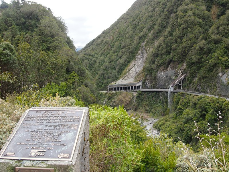
IPENZ 1990 plaque at the Ōtira Gorge Rock Shelter Lookout. Photo K. Astwood, 2014.
More information
Access
There are a number of viewing spots and sign-posted lookouts beside the road.