24 Apr 2023
Sam Archie received the 2021/2022 Francis Small post-graduate scholarship provided by the Engineering New Zealand Foundation through the University of Canterbury, which he used to progress his research on sustainability and urban planning with the Christchurch and Invercargill city councils.
Sam was keen on engineering before he knew it existed.
“I knew from a young age that this would be the path for me. My grandfather was a builder and I'd sit in the shed from barely five, probably six, and bang a few nails into wood for fun while he did his carpentry stuff which was really cool and sparked my interest from a young age.”
He loved math and physics at school, so studying engineering at university was a natural progression.
His post-graduate work started as a six-month project to finish off a final year assignment for his Bachelor of Engineering honours degree from the University of Canterbury.
Sam worked as a civil engineer for about a year or so before doing his Masters in urban planning.
Sam Archie. Image: Sam Archie
“This project was a real eye-opener for me about how we view a bigger picture of society and what challenges we face in our built environment. And hey, I can't really explain it. I just fell in love with it and let the natural path lead,” he says.
“It spoke to me how we can use all this data and think about these bigger problems, things that we hadn't connected the dots before.”
What motivated Sam to take this research path?
“Cities are challenged with many wicked problems: natural hazard risks, climate change, rapid urbanisation, the housing crisis, equity, public transport access, and chronic disease. These issues are interconnected. Solving one may help solve another.
“If we are to try and create healthier, safer and more sustainable cities, we desperately need to choose spatial plans that solve multiple issues simultaneously, without causing other unintended problems.”
Sam’s research looked at how councils might develop strategic plans that coherently integrated information and requirements. The overall aim was to advance spatial land-use planning in Aotearoa New Zealand by developing a sophisticated, yet implementable tool that enables councils to integrate multiple planning objectives and identify areas that may be best suited for development and intensification.
To this end, Sam established partnerships with Christchurch City Council and Invercargill City Council.
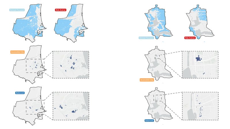
Christchurch Optimal Spatial Plan / Invercargill Optimal Spatial Plan (The maps shown are illustrative and not be used for urban planning, as the relative importance of each objective needs to be consulted with the community). Image: Sam Archie
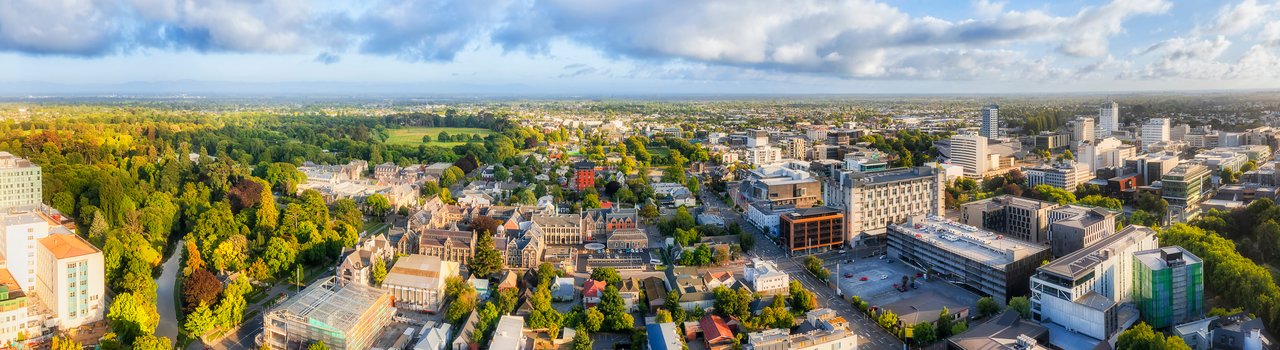
By 2040 approximately 45,000 new homes will need to be built in Greater Christchurch to support the growing population. Invercargill, while very different to Christchurch, is also facing a population boom, with 2,150 new homes needed by 2040 to support its growing population, and other issues including relocation of the airport because of flood risk.
The councils were interested in working together to align the objectives, and it was useful to have two different environments to compare.
“More importantly, our partnerships with the councils allowed us to discover maps of known hazards such as flooding, liquefaction and tsunami, and existing infrastructure such as schools, medical clinics and libraries.”
Sam wanted to explore how the ‘perfect’ place is valued differently in importance, depending on community perspectives. He and the Urban Intelligence team implemented four perspectives:
- Retreat focused: Avoid extreme coastal flooding due to sea level rise
- Risk Averse: Avoid a range of natural hazards, such as liquefiable land, river flooding zones and tsunami-prone areas
- Accessible City: Maximise proximity to schools, parks, clinics, key activity areas and libraries
- Balanced: All of the above, including urban sprawl and land value.
If, for example, scenarios focus solely on retreat and risk aversion, a push to move out of areas prone to hazards will encourage building in more remote areas. This leads to car dependence, as new homes will be further away from existing public infrastructure.
Taking a holistic approach and including risk and sustainability in urban planning can find more intelligent and appropriate places to build.
The resulting engagement with councils is estimated to encourage better development for around 100,000 people within the Greater Christchurch and Invercargill City regions combined.
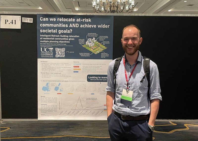
Last year, Sam started noticing his work aligned with issues raised internationally by the Society for Risk Analysis. He applied to present to the Australasian branch, in Melbourne. Then, in December 2022, he travelled to Tampa for the society’s annual meeting and presented his research there.
Sam in Florida. Image: Sam Archie
Sam has now moved into full-time consultancy but continues to work on leveraging data to identify strategic spatial plans though engagement with local rūnanga and councils, with the goal of enabling better understanding of how to make long-term decisions that account for future uncertainty.
He doesn’t think this work could have happened without the Francis Small scholarship.
“Also, I couldn’t have gotten far without the support of my supervisors,” he says, adding “there were a couple of key contacts at the councils, like Jeremy Rees in Invercargill…. Christchurch Council has been amazing to work with. Great partnership.
“We’re coming full steam at the idea that New Zealand needs to start thinking this way,” he says.