3 Aug 2022
Could the understanding of wildfire evacuation behaviour lie in the palm of your hand? As wildfire risk is increasing in Aotearoa and around the world, GPS data from mobile phones is one way to improve evacuation safety for wildfire events.
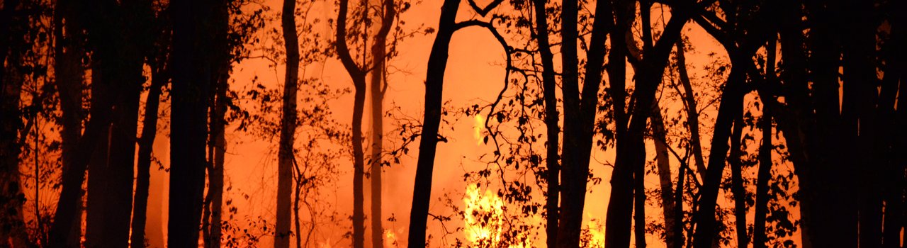
Wildfire is becoming an escalating problem around the world – fires are getting more common and severe. This change is driven partly by climate change, but also by the fact that Wildland-Urban Interface (WUI), the transition area between wilderness and land developed by human activity, is expanding. In recent years, wildfires have posed a threat to properties and human lives, requiring the evacuation of large numbers of people.
Countries like Australia and the USA have experienced many wildfires in the past. However, in New Zealand, these types of wildfires are less common, but are predicted to increase in both frequency and severity in coming years. Examples of two recent major fires are the 2017 Port Hills fire in Canterbury and the 2019 Pigeon Valley fire in the Tasman District, which required swift evacuation.
To effectively plan for future wildfire events, it’s important to understand how people behave, for example, when they decide to evacuate and which evacuation routes they choose. One way to collect this data is to conduct surveys following a wildfire. This approach was used in a recently completed study of the Pigeon Valley fire. Funded by Fire and Emergency New Zealand, the study was conducted by researchers at the University of Canterbury and Massey University. Occupants of Wakefield and surrounding areas were asked to fill out a questionnaire about their behaviour during the fire. Although the study resulted in valuable data, there were clear biases in the responses. People had some difficulty remembering exactly when they evacuated, since they had made decisions under stress. Also, research suggests people’s memories of traumatic events change over time. While, post-incident surveys can provide some useful insights, there’s a need to develop complimentary data collection techniques.
An alternative way to study evacuation is to use GPS data from mobile phones. When you use a mobile app like a navigation app or a game, your location is typically shared with the app developers. This data can be purchased from GPS data providers after being anonymised and used to track devices (phones) over
a period of time.
The use of GPS data during wildfires is being piloted in a research project involving a number of universities here and in the USA. It focuses on the 2019 Kincade fire in Sonoma County in the States which burned more than 300km2, damaging more than 120 buildings
and forcing almost 200,000 people
to evacuate.
By using GPS data from before and during the fire, researchers inferred when people started evacuating, their routes, and where they evacuated to. In addition, it was possible to understand how many ignored official evacuation warnings and orders and remained in their homes. These types of findings can often be difficult to gather using surveys, because people may not want to admit that they acted contrary to official advice.
Although the GPS data is anonymised, it’s still possible to find the home or start location of each device. Using census data, home location can be used to infer socio-demographic factors like education and household income. The use of GPS data, therefore, has the potential to reveal previously unknown factors that can be used for planning of future evacuation, like which areas first responders should prioritise to get everyone out in time.
GPS data from wildfires can undoubtedly reveal new insights about evacuation behaviour, but GPS datasets can be affected by currently unknown biases. For example, it’s expected smartphones, from which GPS data can be retrieved, are predominantly used by a younger population. Also, if the GPS data is from non-navigation apps, then passengers rather than drivers are tracked. This may mean multiple-person households are likely tracked more often than single-person households. Despite these limitations, using GPS data is expected to reveal new trends and is a powerful complement to traditional post-incident surveys.
This ongoing research is funded by the National Institute of Standards and Technology Measurement Science and Engineering Research Grant Programs and conducted by
a research consortium involving:
- Xilei Zhao – University of Florida, USA
- Xiang Jacob Yan – University of Florida, USA
- Daniel Nilsson – University of Canterbury, New Zealand
- Ruggiero Lovreglio – Massey University, New Zealand
- Erica Kuligowski – RMIT University, Australia
- Tom Cova – The University of Utah, USA