4 Dec 2019
What does climate change mean at a domestic level, and what impact does that have on engineers?
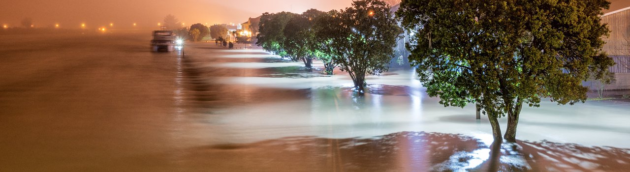
The floodwaters topped 6m before the stopbank failed, releasing the swollen Rangitaiki into the streets of Edgecumbe in April 2017. While the rest of New Zealand was heading to work, the Bay of Plenty town was inundated by a wall of water that flooded 70 percent of the houses and forced the evacuation of around 1,600 residents. At least a dozen homes were destroyed or rendered permanently uninhabitable.
This flood reinforced just how vulnerable parts of New Zealand are to catastrophic inundation. As Sue-Ellen Fenelon CMEngNZ, Manager of Climate Policy at the Ministry for the Environment (MFE), says: “Edgecumbe was a reminder for everyone because it was really traumatic for those affected”.
But it was also a graphic intimation of the destruction we could see more frequently as a result of climate change.
NIWA hazard analysts in Edgecumbe shortly after the 2017 Rangitaiki River flood. Image: Dave Allen/NIWA
A stark assessment based on two reports released earlier this year by the National Institute of Water and Atmospheric Research (NIWA) and the Deep South National Science Challenge reveals the extent of our vulnerability. According to the New Zealand Fluvial (river) and Pluvial (rainfall) Flood Exposure report, almost 700,000 people and more than 410,000 buildings worth $135 billion, as well as 20 airports and 19,000km of roads, are exposed to river flooding from extreme weather events. The second report, Coastal Flooding Exposure Under Future Sea Level Rise, concludes that 72,000 New Zealanders and 50,000 buildings worth $12.5 billion, are at risk of extreme coastal flooding. It says for every 10cm of sea level rise, thousands more individuals and billions worth of homes and assets would come under threat.
And this is not only a future of storm surges and coastal erosion.
“The one issue that I think is under-recognised is drought,” says Tonkin + Taylor Climate and Resilience Specialist James Hughes CMEngNZ CPEng. He was a member of the Government’s cross-sectoral Climate Change Adaptation Technical Working Group in 2017 and 2018, and is now working on the National Climate Change Risk Assessment team.
“Drought incidence is something we need to understand a lot more about, particularly in the north and on the east coast. What are the cascading impacts we might see? For example, if we continue to discharge contaminants into water bodies, and we have more drought conditions, the ability of those bodies to absorb contaminants is affected – there’s a multiplier effect.”
The engineering profession is going to be central to preparing New Zealand for this potential future, shoring up defences against flooding and coastal erosion, adapting cities and infrastructure, and rethinking design.
There will also be an element of communicating these new possibilities. In addition to her role at MFE, Sue-Ellen is a member of Engineering New Zealand’s Board.
How can we design our cities to absorb more water, to have more permeability where appropriate?
She says: “Engineers can play a vital role in helping communities to understand.”
Climate change is a planetary phenomenon with specific local effects. Recently, Tonkin + Taylor helped Local Government New Zealand (LGNZ) to quantify that sector’s exposure. According to the 2019 report, Vulnerable: The Quantum of Local Government Infrastructure Exposed to Sea Level Rise, nearly $8 billion worth of council infrastructure is likely to be at risk from a 1.5m rise in sea level. With sea level rise of 3m, the exposure reaches $14 billion.
Says James: “We’ve prepared guidance for elected members and senior officials, which includes questions for technical staff. ‘Are you collecting the right environmental or climate data? Do you understand flood hazards? Does your flood modelling allow for climate projections? Are you monitoring rainfall or groundwater levels?’ It’s about having the right information available to make informed decisions.”
For the engineering profession, climate change means rethinking design parameters.
“How are we managing events over and above our normal parameters? We need to check that no catastrophic damage occurs with climate change added on top.”
James says engineers also need to work more collaboratively with other disciplines.
“Particularly in the land use planning context – planners, ecologists, urban designers and so on. There’s a recognition that a water-sensitive design approach is more climate resilient, so how can we design our cities to absorb more water, to have more permeability where appropriate?
“For example, having more green buffers not only responds to increasing flood hazard, but also to issues of temperature and shade, while having other benefits such as biodiversity.”
Engineers can bring their expertise to designing adaptive solutions, he adds.
“How can we design systems that are more flexible or adaptable or modular? Given uncertainty in the future, are we designing something that we are going to have to rebuild completely if and when its design capacity is exceeded, or can we build solutions in a way that can be easily augmented?”
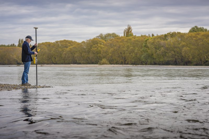
NIWA scientist Dr Murray Hicks operating a Real-Time-Kinematic GPS (RTK-GPS) in the Waimakariri River. Image: Dave Allen/NIWA
This adaptive approach is in keeping with a new approach to planning at the local and national level. In a 2017 guidance document, Preparing for Coastal Change, MFE recommended that local government adopt “dynamic adaptive pathways planning” – essentially, maintaining flexibility in the face of an uncertain future.
“It’s about recognising that if you do something now, you need to consider whether it’s the right solution for 100 years from now, and whether it’s the best use of available money, so you line up a whole lot of decision pathways for different options,” says Sue-Ellen.
So, what’s happening on the ground around New Zealand?
Ramon Strong CMEngNZ CPEng IntPE(NZ) is Group Manager River Management for Horizons Regional Council, which covers the Manawatu-Whanganui region and includes 160km of western coastline, as well as the Whanganui and Manawatu rivers. Ramon says river managers from Northland to Southland have climate change front of mind.
“It’s a big focus for us, and there’s a lot of discussion about how we can achieve a greater level of protection for our communities over time.”
In the case of Horizons, a 2016 analysis by NIWA, Climate Change and Variability – Horizons Region, determined that the net effect on flood frequency for Palmerston North isn’t large.
“In part, that’s because the west is likely to get wetter, and the east drier, and the catchment spans both,” he says.
For the same reason, however, the Whanganui River is likely to flood more frequently. The council is now conducting a more indepth climate change assessment of the Whanganui catchment, Ramon says.
“We want to get a better understanding of the current situation in terms of the likelihood and frequency of large flood events, and to overlay that with what climate change might lead to in terms of changes in rainfall.”
Canterbury’s mighty river
Environment Canterbury (ECan) has just concluded a 10-year endeavour to bolster the flood defences of greater Christchurch and surrounds. The Waimakariri Flood Protection Project involved the upgrade of 35km of primary stopbank and the construction of a 25km secondary stopbank, increasing the design flood capacity to 5,500 cumecs and 6,500 cumecs respectively.
“It’s recognised that climate change will increase the risk of these design floods over time, but the very high standard of protection offered by the combined system provides substantial future-proofing for climate change effects,” says ECan Principal River Engineer Ian Heslop CMEngNZ CPEng IntPE(NZ). Nevertheless, he adds, “the Waimakariri River flood protection system and floodplain management approach will need to be continuously monitored, modified and upgraded to keep pace with increasing flood flows and sea level rise”.
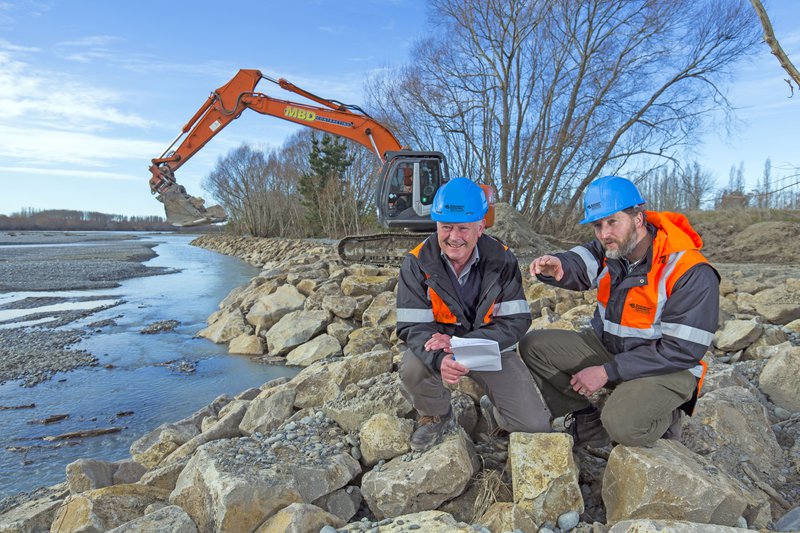
Ian Heslop and Matt Surman (Environment Canterbury), check rock erosion protection on the Waimakariri River. Image: Environment Canterbury
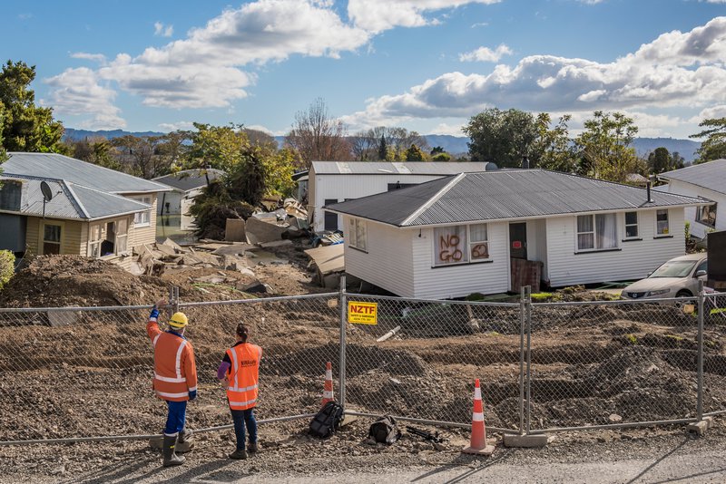
Identifying impacts of flooding
Also in Canterbury, the Selwyn District Council recently engaged spatial data experts Mappazzo to build a 3D reconstruction of the flood-prone Leeston township, where the council has invested heavily in flood deviation infrastructure.
“They needed to get their heads around what remaining flooding would be happening,” says Mappazzo Managing Director and engineer Kelly Norris. Using drone photogrammetry overlaid with hydraulic modelling data, the 3D reconstruction of Leeston can be used by the district council to identify specific impacts of predicted flooding and communicate risks to the community.
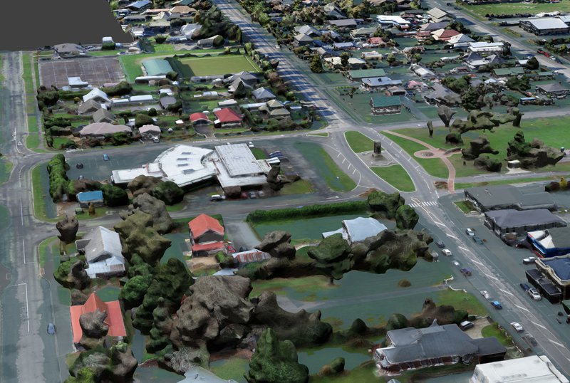
3D reconstruction of flooding in Leeston, Canterbury. Image: Mappazzo
Lying low
In low-lying South Dunedin, which has a track record of damaging flooding, the Dunedin City Council has budgeted $35 million over 10 years for alleviation measures. But given the likelihood of rising sea level and more frequent severe weather events, a long-term fix is needed.
South Dunedin is not only home to 9,000 residents, some of whom live less than 50cm above sea level, but also a Transpower substation, a sizeable commercial district and Dunedin’s main water treatment plant.
“And it’s not only an issue of rising groundwater and sea level, because there are also geological hazards present,” says Otago Regional Council General Manager Operations Gavin Palmer CMEngNZ.
“We need to take a multi-hazard approach.”
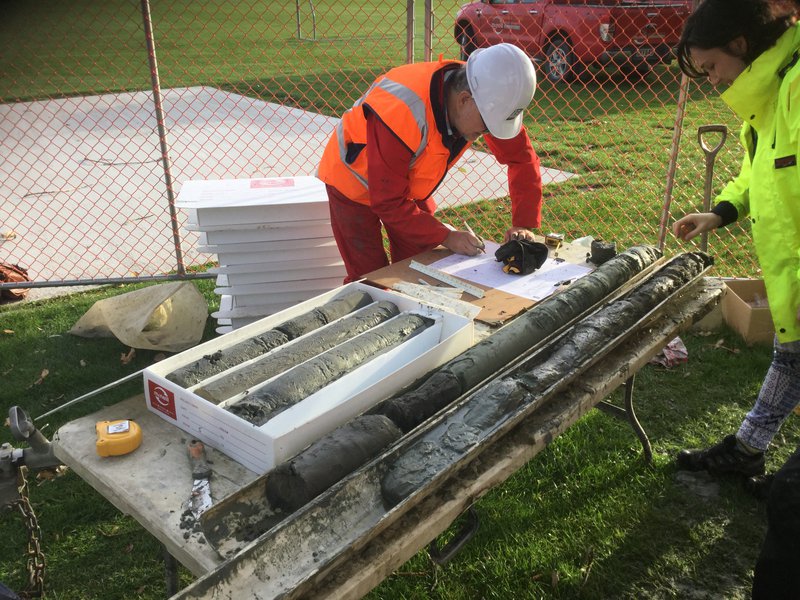
Sharon Hornblow (Otago Regional Council) and Phil Glassy (GNS Science) analyse core samples recovered from a drill hole at Tonga Park, South Dunedin. Image: Otago Regional Council
The Otago Regional Council and the Earthquake Commission have funded a research project to better understand the relationship between groundwater and sea level in South Dunedin, using pressure-sensitive piezometers deployed in 15-metre-deep holes drilled across the suburb. Gavin says the data is still being analysed, but can say “that as sea level rises in the future, we can expect that permanent groundwater levels will also rise in parts of South Dunedin, making flooding more likely”.
Stormwater management will only be one part of the response, he suggests, and engineers will play a key role in finding other answers.
“This is going to require consideration of all potential options. I think engineers are well-placed to do that, because this is what they do well: think long-term and holistically about solutions.”
This article originally appeared in the December 2019 issue of EG magazine.