Date: |
21 May 2026, 5.15PM – 7.15PM |
duration: |
2 hrs |
Venue: |
Aerial Surveys |
Address: |
5 Trent Drive Nelson |
Cost: |
Free event |
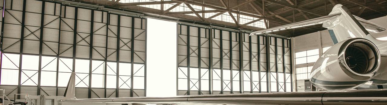
You’re invited to a unique behind‑the‑scenes visit to Aerial Surveys, one of New Zealand’s leading geospatial and aerial survey providers.
Aerial Surveys have generously opened their aircraft hangar to host us for an up‑close look at their operations, technology, and specialised aircraft. With three fully operational aircraft equipped with large‑format cameras and advanced LiDAR sensor technology, Aerial Surveys delivers high‑quality geospatial products across a wide range of applications. This visit offers a rare opportunity to see how cutting‑edge aerial survey data is captured from the aircraft themselves to the sensors that make it all possible.
We will be guided through the hangar by the Aerial Surveys operations manager and a pilot, who will walk us around the available aircraft, explain their capabilities, and share insights into day‑to‑day aerial survey operations. There will be plenty of opportunity to ask questions and learn more about how aerial imagery and LiDAR data are collected and used in practice.
Following the hangar tour, we’ll head to Speight’s Ale House to continue the conversation over drinks and nibbles in a relaxed setting. This is a great chance to network, share experiences, and connect with others who have an interest in aviation, geospatial technology, and the work Aerial Surveys does.
We look forward to an engaging and informative evening. Don’t miss it!
PPE Required: Hi-vis jacket.
Step inside the world of aerial surveying with an exclusive hangar walk around at Nelson Airport, followed by drinks and nibbles at Speight’s Ale House.
You’re invited to a unique behind‑the‑scenes visit to Aerial Surveys, one of New Zealand’s leading geospatial and aerial survey providers.
Aerial Surveys have generously opened their aircraft hangar to host us for an up‑close look at their operations, technology, and specialised aircraft. With three fully operational aircraft equipped with large‑format cameras and advanced LiDAR sensor technology, Aerial Surveys delivers high‑quality geospatial products across a wide range of applications. This visit offers a rare opportunity to see how cutting‑edge aerial survey data is captured from the aircraft themselves to the sensors that make it all possible.
We will be guided through the hangar by the Aerial Surveys operations manager and a pilot, who will walk us around the available aircraft, explain their capabilities, and share insights into day‑to‑day aerial survey operations. There will be plenty of opportunity to ask questions and learn more about how aerial imagery and LiDAR data are collected and used in practice.
Following the hangar tour, we’ll head to Speight’s Ale House to continue the conversation over drinks and nibbles in a relaxed setting. This is a great chance to network, share experiences, and connect with others who have an interest in aviation, geospatial technology, and the work Aerial Surveys does.
We look forward to an engaging and informative evening. Don’t miss it!
PPE Required: Hi-vis jacket.
Presenters
Nelson-Marlborough Branch